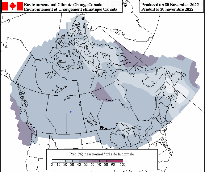
Grande Prairie residents should get ready to bundle up pretty often this winter. Environment Canada has released its three-month outlook forecast for December, January, and February, with Meteorologist Brian Proctor suggesting there is a greater chance for western Canada, specifically northern Alberta, northern British Columbia, and northern Saskatchewan to be colder than normal.
“There is a couple reasons this is happening: one is the long-term effects we are seeing with the upper air flow pattern; we are seeing these trophies over western Canada, and it’s really a lot of cold air coming down out of the Arctic,” Proctor says. “That is really what we are seeing a continuation of that kind of pattern.”
In the short term, over the next seven to 10 days, Proctor explains that the temperature across the province is going to stay decently cold, warming up slightly towards the end of next week before more cold air follows behind it. Once the cold air starts coming down from the Artic and airflow gets locked into this sort of pattern, it will take some sort of significant change in the upper air flow to adjust the pattern and Proctor says there isn’t any indication of an adjustment at this point.
When comparing this year’s projected conditions to last year’s weather, there are a few significant differences. The first is last year’s cold weather that came in from a strong La Niña that lingered, with the cold air coming from the Arctic, and cold water sitting off the B.C. coast. This year, Environment Canada is seeing a La Niña coming in, but it is not as strong as last year, meaning it will be colder than usual but not as severely cold as last year. Proctor adds that when it comes to looking at precipitation over the next three months it is a little harder to get a signature until temperatures are more defined to look at in the long term.
“When we do look at precipitation anomalies for that period, December, January, February our models are indicating above normal precipitation for much of Alberta and that is typically what we would expect with a Proctor that is sort of developing. I wouldn’t be surprised to see more snowfall than normal.”
Proctor adds he doesn’t expect to see any tremendous amounts of snow with the way the models are looking. However, these types of factors in a long-range forecast are very fluid and can drift quite a bit. Individual storms or low-pressure systems that come through can change the precipitation models by quite a bit throwing the model out.
Proctor says the most important thing he can say is, “We are Albertans; we’re used to winter and we are going to be experiencing some winter over the next little while.” He advises drivers to be sure to adjust their driving conditions to the weather conditions, to dress for the weather, and to have an emergency kit with them in their vehicle while they’re travelling.


