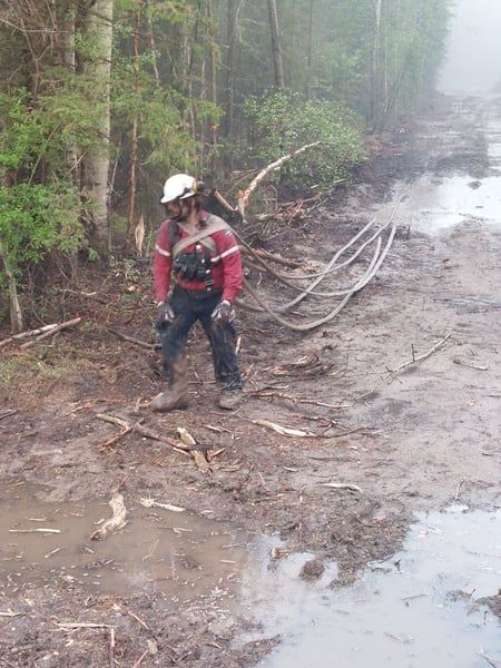
As of 7:30 p.m. Sunday May 22nd, the Sturgeon Lake Complex, which consists of the Sturgeon Lake and the Little Puskwaska wildfires, is listed as being held. The Sturgeon Lake fire is estimated to be 5,752 hectares in size while the Little Puskwaska fire is estimated to be 3,869 hectares in size.
According to Alberta Wildfire, a combination of the amount of resources committed to the fires, the work already done in the area, and current weather forecasts will help stop the spread beyond the existing boundary. Though listed as being held, the fire is not extinguished and is still active, with hundreds of hot spots within the perimeter.
According to officials, rain and precipitation the area has seen since Sunday afternoon has caused the fire to show no visible activity. On Monday, the MD reduced the evacuation zone, however an evacuation order remains in effect for everyone south of Township Road 720, west of Range Road 223, north of Township Road 712, west of Range Road 231, south of Township Road 705A, and west of Range Road 230 up to the east border of the Sturgeon Lake Cree Nation east border, including Young’s Point Provincial Park.
The Eagle Complex wildfires showed no further growth towards the Town of Fox Creek Monday and are approximately 72,830 hectares in size. Weather in the area kept helicopters grounded Monday while crews worked on the fire guards along the perimeter of Iosegun Lake road, and set up more hose line along excursion south of Highway 43.
On Monday, the wildfire areas saw between five to 27 millimetres of rain throughout the day. According to the Town of Fox Creek, around 12 select critical infrastructure workers for the hospital, the grocery store, utilities including power and gas, along with required municipal staff were allowed into the evacuation zone to establish services for when residents are allowed to return home.
“Plans are underway to re-open the community to the general public as soon as it is safe to do so. Triggers have been put into place that include the containment of the fire along the perimeter and received precipitation. At this time, we are still unsure of when those triggers will be met.”
The Bald Mountain wildfire, as of Monday night, was estimated to be around 19,435 hectares in size and was approximately 17 kilometres west of Highway 40. The fire crossed Bald Mountain Road to the east and “is in proximity to the intersection of Odum Ridge Road and Bald Mountain Road to the south.” Parts of the fire are considered to be contained, including near Two Pinto Road, near Bald Mountain Road and Nose Mountain Road.


